- EyeVi raised 2 million dollars in a seed round for its AI-based road maintenance technology.
- The company captured investors’ interest with geospatial data processing and AI infrastructure maintenance solutions.
- EyeVi aims to make road inspections much cheaper and more effective.
Very rarely is any road smooth and pothole-free. And yet, there could be many more paths in a better shape if only cities and municipalities could rely on preventative maintenance instead of fixing the damages once they are already visible and harmful to road users. EyeVi is a company that brings solutions to these needs using AI-driven solutions. The platform created by the Estonia-based start-up allows predicting the need to maintain the road before it actually breaks. Such a proactive and preventative approach provides solutions for more cost-effective and sustainable use of the city’s budget. Fixing problems when they are already visible proves to be even 20 times more expensive.
The start-up recently raised 2 million dollars in a seed round for its technology. ff Venture Capital was a leading investor, while other participants include RKKVC, Decacorn Capital, Iron Wolf Capital, Super angel, Spring Capital, Kaamos Group, and several Estonian business angels.
Creation of an industry-savvy and experienced team
EyeVi was founded in 2020 by a group of data scientists, engineers, and geospatial experts. Gaspar Anton, the company’s founder and CEO, spent more than ten years in management positions at the company, which was the Estonian pioneer of geographic information systems (GIS). Along with several other members of the EyeVi team, he has also been involved in Baltic road mapping for Google Street View.

Gaspar Anton, founder and CEO of EyeVi
Gaspar Anton explained that ‘EyeVi clients are road consulting and road asset management companies. They have numerous users consisting of engineers and analysts who use our cloud platform and viewing tools to get insights into road conditions and verify data.’ These ‘road consultants’ provide services and expertise to the public sector – road authorities, cities, and municipalities. EyeVi also supports companies that create software solutions for managing road assets, such as pavement, earthworks, drainage, safety barriers, lighting, signs, lines, and soft estate (grass and trees). ‘These valuable assets ideally need to be monitored and managed, and therefore require asset management systems which are GIS-based, to manage the asset information properly.’ – said Anton.
Unique solution for road infrastructure analysis
EyeVi is a data processing platform based on Artificial Intelligence, thanks to which clients can use machine-learning-based analytics to process geodata and predict the need for road maintenance. It’s developed entirely in-house and not based on existing solutions, such as Google Maps. The company’s founder said: ‘EyeVi’s solution allows engineers to build the digital twin of the infrastructure to make city and road infrastructure simulations. With digital twins, clients can simulate scenarios and analyse the impact of different decisions. We extract information and features from road infrastructure data ranging from road defects like potholes and cracking to accurate measurements and locations of road furniture like signs and posts. As a result, EyeVi makes road inspection 14 times faster and ten times more effective.’
- EyeVi Visual Application
- EyeVi Web App
- EyeVi Web App
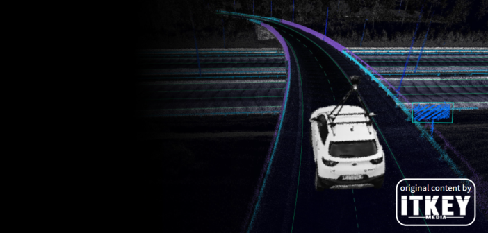
The company uses GNSS/INS systems, 360° panoramic cameras, and LIDAR scanners to produce geo-referenced point clouds. Gaspar Anton told us: ‘Point cloud is a set of data points in space, and in our case, we use it to visualize road infrastructure in 3D. From the point cloud data, we know where assets are, we can extract their measurements and use AI to detect features.’ This technology is also used to build HD maps for innovative city and autonomous vehicle applications. In the future, EyeVi is planning to take advantage of the growth of these two sectors.

Mateusz Bodio, RKKVC
The start-up’s uniqueness is that it provides solutions for road infrastructure analysis using computer vision technologies, as Mateusz Bodio, RKVCC, told us. ‘Their technology enables much more accurate capture of images from cameras than in the case of other solutions, and thus better monitoring and mapping of road objects.’ Moreover, according to Bodio: ‘What is the advantage of EyeVi over the competition is the fact that their software accounts for customers based on the number of kilometers analysed, and if the customer needs it, the company can provide easy-to-install hardware solution anywhere in the world.’
Plans to expand to US
EyeVi is present in Estonia, the United Kingdom, Finland, Sweden, Norway, and Poland. Having the competitive advantage of specialising in the analysis of infrastructure details, the company is looking into Central and Southern Europe and African and Asian markets. Using the funds received and having in mind that the American government is preparing significant investments in infrastructure, they aim to expand to the US market to reach 1 million miles by the end of 2023. They have a big chance of success. James Wallis, Managing Director of XAIS, the company that covered 8000 km of roadway in 2021 using the system, said about the start-up: ‘They have passion and expertise in this field to develop tools for engineers. We viewed this in comparison with other similar systems that utilise AI in this regard, and nothing came close to EyeVi.’

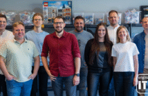
EyeVi Team
Agata writes content for NGOs, private and public sector. She enjoys writing about new technologies and is fascinated by all things AI!


